El Nido Distances
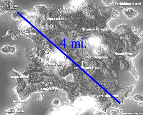
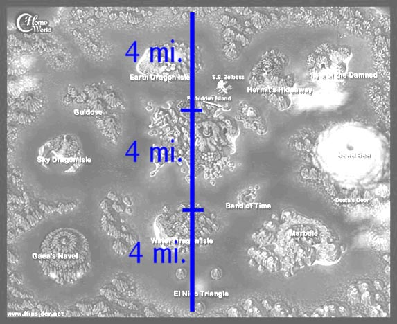
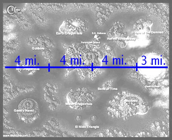
Below I have included three maps of El Nido indicating how far I believe the islands may be in relation to one another and how I made my measurements. For this page I have used the example of four miles, but seeing as how the diagonal distance of the main island need not be exactly this figure, feel free to substitute it for a number more to your liking. The lower two maps have the figures to scale, meaning each horizontal or vertical segment marking 4 miles corresponds to the size of the main island on that map. Subsequently, you can use the equations:
3(x) = vertical distance
3(x) + 0.75(x) = horizontal distance
In this case x being the diagonal diameter of the main island. So for instance, if you feel the main island is only 3 miles in diameter you can substitute that number in for x to determine the desired distance.
|
|
|
I would also like to take this opportunity to express thanks to Final Fantasy
Insider for providing both maps of El Nido. To see the full-color originals
and other interesting media please visit their site at:
Affiliation
•
Cartography
•
Conjecture
•
Encyclopedia
•
Essays
•
Illustrations
Inquiries
•
Misconceptions
•
Mysteries
•
Script
•
Timelines
•
Timetables